Description
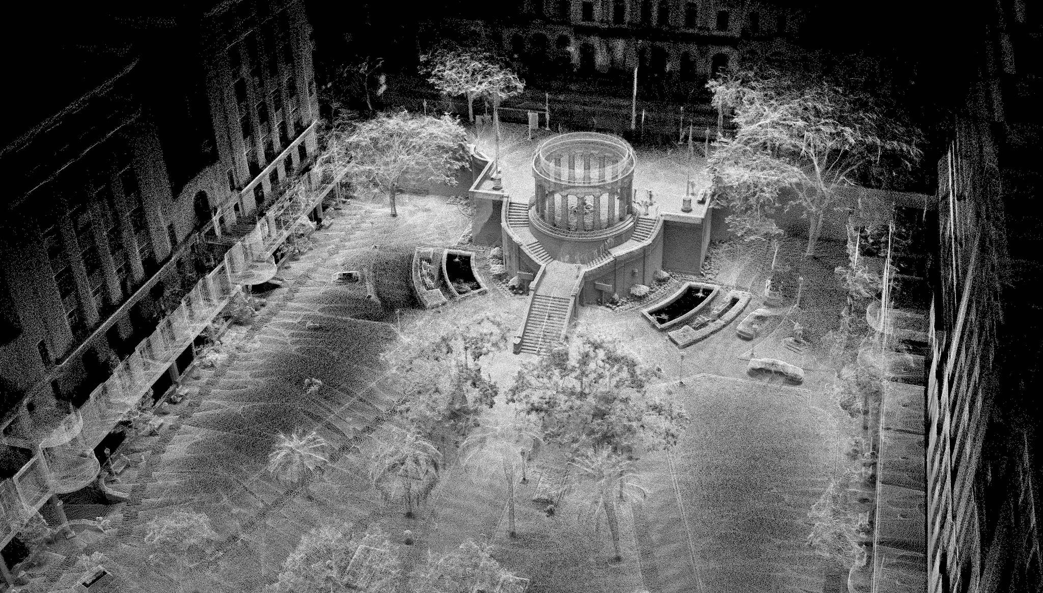
The GeoSLAM ZEB Horizon is a versatile mobile LiDAR scanner that excels at capturing 3D data in a wide range of environments, particularly those without GPS coverage, such as indoors, underground, or in heavily forested areas. When paired with the GeoSLAM Connect software, it becomes a complete solution for data capture and processing.
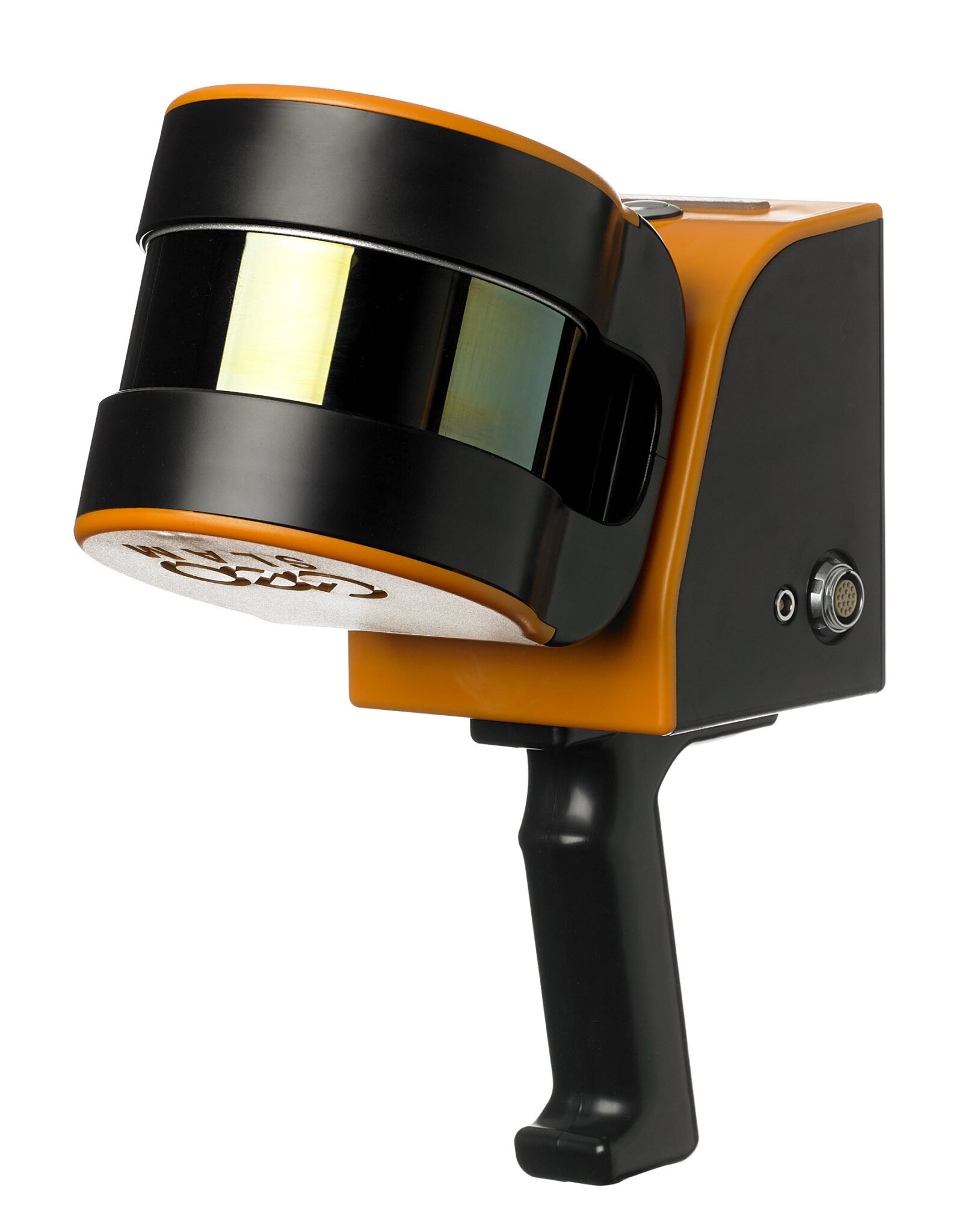
The ZEB Horizon Scanner
- Technology: The system uses Simultaneous Localization and Mapping (SLAM) technology to build a 3D point cloud and determine its own position simultaneously. This allows a user to simply walk through an environment while the scanner rapidly collects data, eliminating the need for stationary setups
- Performance: The ZEB Horizon is a high-performance scanner with a rapid data collection rate of 300,000 points per second and a range of up to 100 meters. This makes it highly efficient for mapping large and complex spaces.
- Accuracy: It provides a survey-grade relative accuracy of up to 6mm, allowing for the creation of detailed and precise models.
- Versatility: The ZEB Horizon is designed to be “go-anywhere.” It can be used handheld, mounted on a backpack, a vehicle, or even a drone with an optional mount, providing a single solution for multiple applications.
- Georeferencing: The system is typically used for local-level mapping where the point cloud is self-contained. For projects that require the data to be placed in a real-world coordinate system, it can be georeferenced using a “stop-and-go” method with known control points.
The GeoSLAM Connect Software
GeoSLAM Connect is the post-processing software that accompanies the ZEB Horizon. It is a powerful platform that automates many of the complex steps involved in converting raw scan data into usable deliverables.
- Automated Processing: At the core of Connect is an automated workflow. With a single click, users can process, clean, and prepare their data. This includes applying the proprietary SLAM algorithm to align the scan data and create a clean point cloud.
- Data Filtering: The software includes tools for filtering out unwanted noise, such as stray points or moving objects, to improve the quality and clarity of the final point cloud.
- Georeferencing: Connect facilitates the process of georeferencing by allowing users to use control points or a GPS-enabled system (like the optional ZEB Locate) to place the point cloud in a real-world coordinate system.
- Workflow Automation: The software streamlines the entire process, from data import to final export. It can automatically apply pre-defined workflows and prepare the data for use in third-party software like CAD or GIS applications.
The GeoSLAM ZEB Horizon Solution with Connect is a mobile mapping ecosystem that combines a high-speed, versatile LiDAR scanner with an intelligent, automated software platform. This combination allows users to rapidly capture high-quality 3D data in challenging environments and quickly turn it into actionable information with minimal manual effort.

Reviews
There are no reviews yet.